NASA scientists say tracking changes in polar ice can help them better predict changes in climate and sea level. NASA's Operation IceBridge mission - the largest-ever airborne survey of the Earth's polar ice - kicked off its second year of study this week.
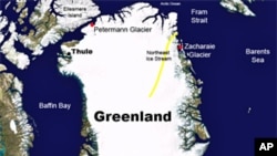
Scientists and a NASA aircraft equipped with a variety of science instruments began this phase of the mission in Thule, Greenland. For the next two and a half months, researchers will survey Arctic sea ice, ice sheets and glaciers to see the ways the ice is changing.
John Sonntag is a scientist and member of the Operation IceBridge management team. He says the operation provides a great deal of knowledge about Greenland and Antarctica - two regions he says are key to better understanding the planet's climate.
"A lot of scientists believe that climate change will first show up at the polar region, so if they were to start to melt, which many people believe they are, then the eventual effect would be a warmer climate overall," said John Sonntag.
Scientists can track changes in the extent and thickness of polar ice by comparing their new findings with the information they gathered this time last year, during the first mission of Operation IceBridge.
Sometimes people use the phrase "glacial pace" to describe something that moves very slowly. But Bryan Blair, of Goddard Space Flight Center near Washington, says glacial regions are actually very dynamic because a lot of ice is moving and there are many vertical changes.
"We can map that entire area and capture the full spacial variability of that change, which is really a good indication of the mechanics of how that change is happening," said Bryan Blair.

NASA's nearly 50-meter-long DC-8 aircraft uses lasers to measure changes in the surface elevation of polar ice. The lasers are reflected from the ground back to the aircraft, and these readings are converted into elevation maps.
The DC-8 is the largest aircraft in NASA's airborne science fleet. It is expected to spend about 200 hours in the skies over Greenland during March and early April. A smaller aircraft will make additional flights in late April and May.
In October and November, Operation IceBridge will survey Antarctica. NASA says glaciers and ice sheets in the Antarctic hold about 90 percent of the Earth's freshwater.
This operation is called IceBridge because its annual missions are meant to bridge the gap until the launch of the second Ice, Cloud and Land Elevation Satellite, which is set for 2015.